Jet Stream
The Slippy Scan been improved by adding an 11um AHI image that tracks your cursor as you mouse over the lidar data.
While testing, I found what I think is the jet stream, showing up as cloud streaks.
Is it really the jet stream?
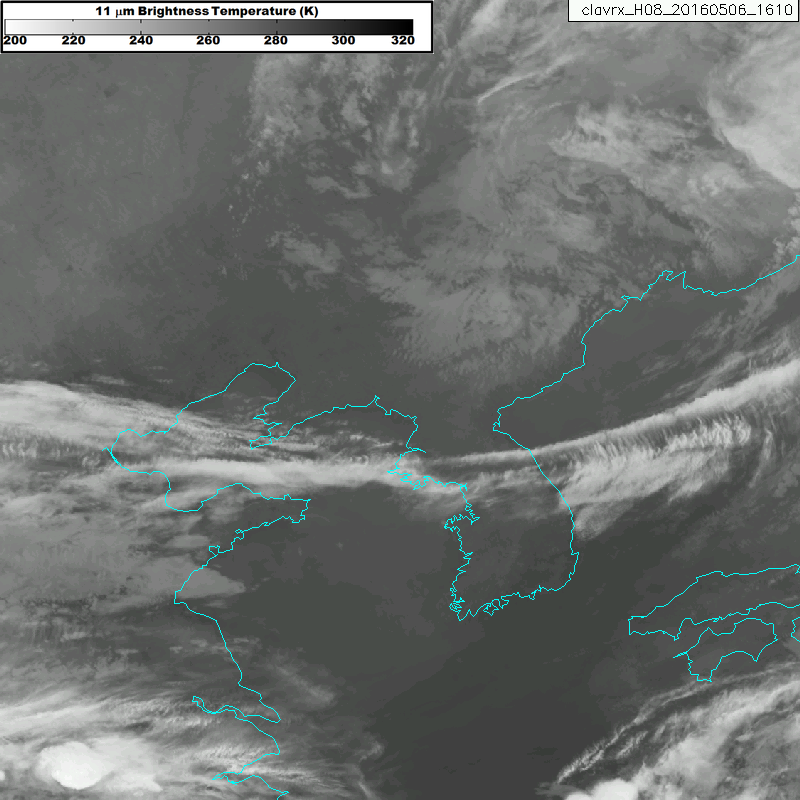
Googleing around I found an SFSU site hosting archived jet stream images. On the left-hand side you see Korea is directly under the strongest wind speeds, evidence that we are indeed looking at the jet stream and not a synoptic front.

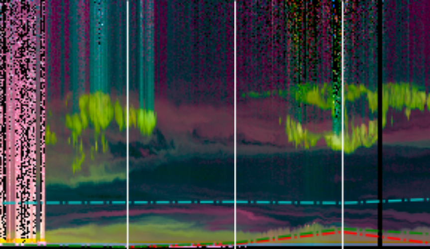
What can we see with HSRL?
Looking at the HSRL data you can clearly see the band of clouds from the satellite image, as well as an aerosol layer. These are located at about 10km, exactly we would expect the jet stream. From the color of the aerosol, the jet stream appears to be transporting dust. It is also transporting moisture, using the dewpoint depressions we see that the atmosphere is very dry except for the jet stream.
Conclusions
In the future I’d like to add trajectory data, so I can know where these aerosols/dust are coming from.